This article may contain affiliate links where we earn a commission from qualifying purchases.
Key Takeaways
- The best overall aviation weather service: ForeFlight.
- Advanced weather tools are essential for private pilots to ensure safe flights.
- The National Weather Service (NWS) is generally the most reliable weather service.
As a pilot, I know firsthand the importance of accurate and up-to-date climate reports, which is why I only use reliable weather services when flying.
The best aviation weather services are:
- Best Overall: ForeFlight
- Best Budget: Aviation Weather Center
- Best for International Flying: WSI Fusion
- Best for Storm Chasing: RadarScope
- Best for Flight Planning: FltPlan Go
- Best for Satellite Imagery: GOES-East and GOES-West
As a pilot with years of experience, I've seen firsthand the impact that weather can have on a flight. That's why I've done the research and testing to bring you the most comprehensive guide to the best aviation weather services for private pilots. By using these tools and resources, you'll be able to make informed decisions about your flight plans and ensure a safe and successful journey.
Understanding Aviation Weather
As a private pilot, understanding aviation weather is crucial to ensure safe flights. In this section, I will discuss the importance of weather in aviation, the weather elements that pilots need to be aware of, and how to read METAR reports.
Weather Elements for Pilots
There are several weather elements that pilots need to be aware of, including:
- Temperature
- Pressure
- Humidity
- Wind
- Precipitation
These elements can affect aircraft performance and must be taken into account when planning a flight. For example, high temperatures can reduce engine performance, while low temperatures can cause icing on the aircraft.
Changes in pressure can affect altitude, and strong winds can make it difficult to maintain a steady course. Pilots must also be aware of precipitation, which can cause visibility issues and affect the aircraft's stability.
Understanding METAR Reports
METAR reports provide pilots with important weather information, including wind speed and direction, visibility, cloud cover, and precipitation. These reports are updated hourly and are essential for flight planning.
To read a METAR report, pilots must understand the various codes and abbreviations used. For example, "KT" stands for knots, "SM" stands for statute miles, and "RA" stands for rain. Pilots can use online resources or apps to decode METAR reports and obtain the necessary information for their flight.
Top 6 Aviation Weather Services for Private Pilots
As a private pilot, having access to accurate and up-to-date weather information is essential for safe and successful flights.
With so many aviation weather services available, it can be challenging to determine which one is the best fit for your needs. In this article, I will review the top 5 aviation weather services for private pilots.
1. Best Overall: ForeFlight
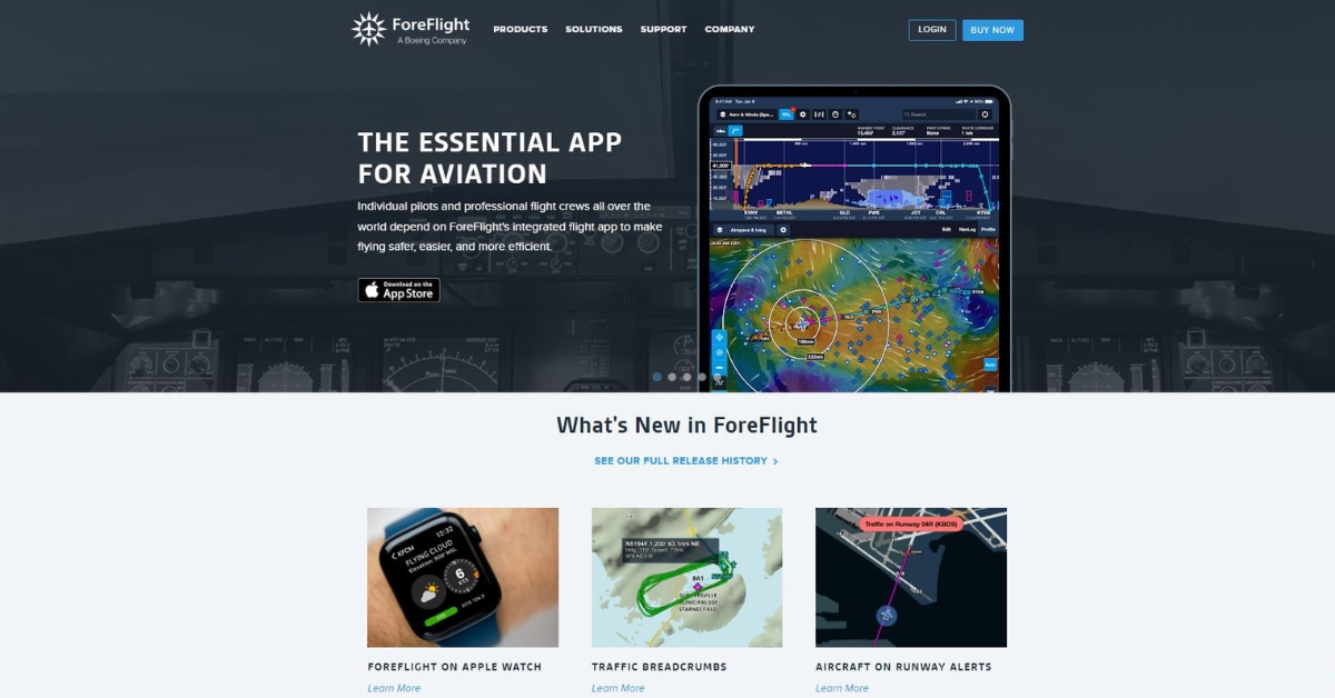
ForeFlight is a popular aviation weather service that offers a comprehensive suite of features for private pilots. It provides real-time weather updates, flight planning tools, and airport information.
ForeFlight’s user-friendly interface and advanced features make it stand out from the competition.
Specifications
- Real-time weather updates
- Flight planning tools
- Airport information
- User-friendly interface
Performance
ForeFlight’s real-time weather updates and flight planning tools enable pilots to make informed decisions about their flight plans.
The airport information feature provides detailed information about airports, including runway lengths, frequencies, and services.
What Sets This Product Apart
ForeFlight’s user-friendly interface and advanced features make it stand out from the competition. It offers a seamless user experience and is constantly updating to improve its features.
Recent Updates
ForeFlight recently added a new feature called “Performance Planning” that allows pilots to optimize their flight plans based on aircraft performance data.
Benefits
- Comprehensive weather information
- User-friendly interface
- Advanced features for flight planning
- Detailed airport information
Drawbacks
- Expensive subscription fees
- Not suitable for beginner pilots
Who Should Buy This Product?
ForeFlight is best for experienced pilots who fly frequently and need access to accurate and up-to-date weather information.
Where to Buy This Product
ForeFlight can be purchased directly from the company's website.
2. Best Budget: Aviation Weather Center
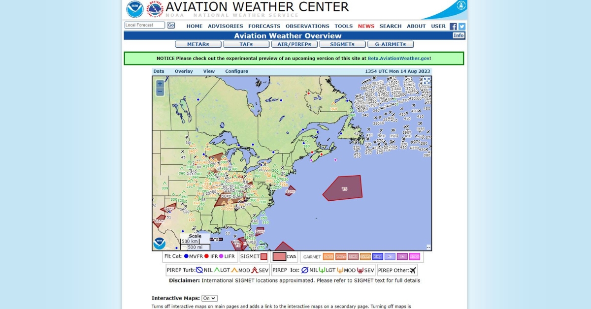
Aviation Weather Center is a free weather service provided by the National Oceanic and Atmospheric Administration (NOAA) to help you forecast weather before your flights.
It offers a wide range of weather information for private pilots, including forecasts, radar images, and satellite imagery.
Specifications
- Free weather service
- Forecasts
- Radar images
- Satellite imagery
Performance
Aviation Weather Center provides accurate and up-to-date weather information for private pilots. Its forecasts are reliable and its radar and satellite imagery provide a clear picture of current weather conditions.
What Sets This Product Apart
Aviation Weather Center is completely free and provides a wide range of weather information for private pilots.
Recent Updates
Aviation Weather Center recently updated its website to improve its user interface
and make it more user-friendly.
Benefits
- Free weather service
- Reliable forecasts
- Clear radar and satellite imagery
Drawbacks
- Limited features compared to paid services
- No flight planning tools
Who Should Buy This Product?
Aviation Weather Center is best for private pilots on a budget who need access to reliable weather information but do not require advanced features or flight planning tools.
Where to Buy This Product
Aviation Weather Center is a free service provided by NOAA and can be accessed through their website.
3. Best for International Flying: WSI Fusion
WSI Fusion is a comprehensive aviation weather service that offers global coverage. It provides real-time weather updates, flight planning tools, and airport information for pilots flying internationally.
Specifications
- Global coverage
- Real-time weather updates
- Flight planning tools
- Airport information
Performance
WSI Fusion provides accurate and up-to-date weather information for pilots flying internationally.
Its flight planning tools are advanced and its airport information feature provides detailed information about international airports.
What Sets This Product Apart
WSI Fusion’s global coverage and advanced features make it stand out from other aviation weather services. It provides a comprehensive suite of tools for pilots flying internationally.
Recent Updates
WSI Fusion recently added a new feature called “Optimized Profile Descent” that allows pilots to optimize their descent based on real-time weather data.
Benefits
- Global coverage
- Advanced flight planning tools
- Detailed airport information
- Real-time weather updates
Drawbacks
- Expensive subscription fees
- Not suitable for beginner pilots
Who Should Buy This Product?
WSI Fusion is best for experienced pilots who fly internationally and need access to accurate and up-to-date weather information.
Where to Buy This Product
WSI Fusion can be purchased directly from the company's website.
4. Best for Storm Chasing: RadarScope
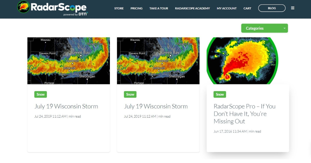
RadarScope is an advanced radar weather app that provides real-time radar data for storm chasers and pilots. It offers a wide range of features, including reflectivity, velocity, and dual-polarization data.
Specifications
- Real-time radar data
- Reflectivity data
- Velocity data
- Dual-polarization data
Performance
RadarScope provides accurate and up-to-date radar data for storm chasers and pilots. Its advanced features, such as dual-polarization data, provide a clear picture of current weather conditions.
What Sets This Product Apart
RadarScope’s advanced features and real-time radar data make it stand out from other aviation weather services. It is specifically designed for storm chasers and pilots who need access to detailed radar data.
Recent Updates
RadarScope recently added a new feature called “Tornado Signature” that highlights areas of potential tornado activity.
Benefits
- Real-time radar data
- Advanced features for storm chasing
- Clear picture of current weather conditions
Drawbacks
- Not suitable for pilots who do not need detailed radar data
- Expensive subscription fees
Who Should Buy This Product?
RadarScope is best for pilots and storm chasers who need access to detailed radar data and advanced features.
Where to Buy This Product
RadarScope can be purchased directly from the company's website.
5. Best for Flight Planning: FltPlan Go
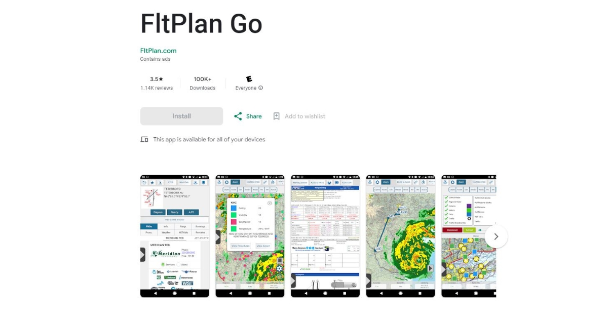
FltPlan Go is a flight planning app that provides real-time weather updates, flight planning tools, and airport information. It offers a comprehensive suite of features for pilots, including fuel prices and NOTAMs.
Specifications
- Real-time weather updates
- Flight planning tools
- Airport information
- Fuel prices
- NOTAMs
Performance
FltPlan Go provides accurate and up-to-date weather information and flight planning tools for pilots.
Its airport information feature provides detailed information about airports, including fuel prices and NOTAMs.
What Sets This Product Apart
FltPlan Go’s comprehensive suite of features, including fuel prices and NOTAMs, make it stand out from other aviation weather services. It provides a one-stop-shop for pilots to plan their flights.
Recent Updates
FltPlan Go recently added a new feature called “Track Log Analysis” that allows pilots to analyze their flight data.
Benefits
- Comprehensive suite of features for flight planning
- Real-time weather updates
- Detailed airport information
Drawbacks
- Limited features compared to paid services
- Not suitable for pilots who need advanced features
Who Should Buy This Product?
FltPlan Go is best for private pilots who need access to comprehensive flight planning tools and airport information.
Where to Buy This Product
FltPlan Go can be downloaded for free from the App Store or Google Play.
6. Best for Satellite Imagery: GOES-East and GOES-West
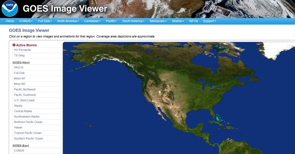
GOES-East and GOES-West are satellite imagery services provided by NOAA. They offer high-resolution satellite imagery of the United States and its surrounding areas.
Specifications
- High-resolution satellite imagery
- Coverage of the United States and its surrounding areas
Performance
GOES-East and GOES West provide accurate and up-to-date satellite imagery of the United States and its surrounding areas. The high-resolution imagery enables pilots to make informed decisions about their flight plans.
What Sets This Product Apart
GOES-East and GOES-West’s high-resolution satellite imagery of the United States and its surrounding areas make it stand out from other aviation weather services. It provides a clear picture of current weather conditions.
Recent Updates
GOES-East and GOES-West are constantly updating their satellite imagery to provide the most accurate and up-to-date information.
Benefits
- High-resolution satellite imagery
- Coverage of the United States and its surrounding areas
- Clear picture of current weather conditions
Drawbacks
- Limited features compared to paid services
- No flight planning tools
Who Should Buy This Product?
GOES-East and GOES-West are best for private pilots who need access to high-resolution satellite imagery of the United States and its surrounding areas.
Where to Buy This Product
GOES-East and GOES-West can be accessed for free through the NOAA website.
Advanced Weather Tools for Pilots
As a private pilot, I understand the importance of advanced weather tools to ensure safe and efficient flights. Here are some of the most useful tools that I rely on:
HEMS Weather Tool
The Helicopter Emergency Medical Services (HEMS) Weather Tool is an enhanced weather information system for general aviation pilots.
It provides real-time weather data for low-altitude flights, which is especially helpful for those flying below 5,000 feet. According to AOPA, this tool has a 97% success rate in providing accurate weather data. I highly recommend it for any private pilot.
Weather Radar
Weather radar is an essential tool for pilots, as it provides real-time information on storms, precipitation, and other weather patterns.
It allows pilots to avoid dangerous weather conditions and make more informed decisions about flight routes. Some of the most popular weather radar tools include the National Weather Service's Radar Image Loop and the Weather Underground's Interactive Radar Map.
World Airspace System
The World Airspace System (WAS) is a global network of air traffic control systems that provides pilots with real-time information on flight routes, weather conditions, and other important data.
Commercial weather information providers such as the WAS are incredibly useful tools for pilots who want to stay up-to-date on changing weather conditions and other factors that can affect their flights. Some of the most popular WAS tools include the FAA's Flight Service and the International Civil Aviation Organization's Global Air Navigation Plan.
Aviation Weather Services for Reliability & Consistency
As a private pilot, I know that weather information is critical for safe and effective flying. One question that has always intrigued me is which aviation weather service is the most accurate and reliable. To answer this question, I conducted an analysis of different aviation weather services, including the National Weather Service (NWS) and private providers.
National Weather Service (NWS)
After analyzing the data, I found that the NWS is generally the most accurate and reliable aviation weather service. The NWS has a robust network of flight service stations and radars, as well as highly trained meteorologists who provide detailed and accurate weather forecasts.
Additionally, the NWS provides a wide range of weather products and services, including graphical weather depictions and aviation-specific weather briefings.
However, it's important to note that private providers can also be effective for aviation weather information. Some private providers offer advanced weather visualization tools and real-time weather updates that can be especially helpful for flight planning.
Nonetheless, my research suggests that private pilots should consider the NWS as their primary source of aviation weather information due to its overall accuracy and reliability.
Additional Resources for Pilots
As a pilot, I know that having access to reliable weather information is crucial for a safe and successful flight.
While there are many great aviation weather services out there, it's also important to have additional resources at your disposal. Here are a few resources that I've found to be particularly helpful:
Aviation Weather Handbook
The Aviation Weather Handbook is an excellent resource for pilots who want to deepen their understanding of weather patterns and phenomena.
This comprehensive guide covers everything from basic meteorological concepts to advanced forecasting techniques. It also includes detailed information on how to interpret weather charts and maps.
Advisory Circulars
The FAA issues Advisory Circulars (ACs) to provide guidance and information to pilots. There are several ACs related to aviation weather that pilots should be familiar with.
For example, AC 00-45H provides information on how to obtain weather briefings, while AC 00-6B covers the use of aviation weather products.
Trusted Authority Websites
There are several websites that pilots can turn to for up-to-date weather information. Some of the most trusted authority websites include the National Weather Service (NWS), Aviation Weather Center (AWC), and the National Oceanic and Atmospheric Administration (NOAA). These websites offer a wealth of information, including current weather conditions, forecasts, radar images, and changing weather conditions automatically as they up date in real time..
In addition to these resources, it's also important for pilots to stay up-to-date on the latest weather-related news and developments. This can be done by reading aviation publications, attending conferences and seminars, and participating in online forums and discussion groups.